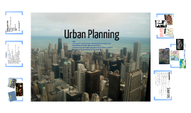
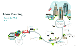
Urban Planning
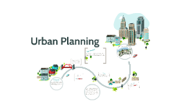
Transcript: Grid City Layout http://maps.google.com/maps/ms?hl=en&gl=us&ie=UTF8&oe=UTF8&msa=0&msid=209011466002072237499.0004b6e2e6d75cfcd298e History Basilica AskJeeves. “Urban planning.” Dictionary.com. http://dictionary.reference.com/browse/urban+planning (accessed January 12, 2012). Boethius, Axel. Etruscan and Early Roman Architecture. 2nd ed. Harmondsworth: Penguin, 1978. City of Chicago.org. “Explore Chicago: The City of Chicago’s Official Tourism Site.” Explore Chicago.org. www.explorechicago.org (accessed January 14, 2012). Dilke, O.A.W. The Roman Land Surveyors: An Introduction to the Agrimensores. Newton Abbot: David & Charles, 1971. Google Images. “Chicago Aerial Photo.” http://www.google.com/imgres?hl=en&gbv=2&biw=1280&bih=699&tbm=isch&tbnid=zlkrt4DXSMMs-M:&imgrefurl=http://www2.loras.edu/college/maps/&docid=ppaSQrPg9SlzHM&imgurl=http://www2.loras.edu/college/maps/statemap-large.jpg&w=691&h=631&ei=PHQYT_GxAcmLgwe277XmCw&zoom=1&iact=hc&vpx=379&vpy=279&dur=120&hovh=215&hovw=235&tx=122&ty=146&sig=100305249962717565629&page=3&tbnh=143&tbnw=157&start=37&ndsp=22&ved=1t:429,r:17,s:37 (accessed January 18, 2012). Google Images. “Dubuque Aerial Photo.” http://www.google.com/imgres?hl=en&gbv=2&biw=1280&bih=699&tbm=isch&tbnid=zlkrt4DXSMMs-M:&imgrefurl=http://www2.loras.edu/college/maps/&docid=ppaSQrPg9SlzHM&imgurl=http://www2.loras.edu/college/maps/statemap-large.jpg&w=691&h=631&ei=PHQYT_GxAcmLgwe277XmCw&zoom=1&iact=hc&vpx=379&vpy=279&dur=120&hovh=215&hovw=235&tx=122&ty=146&sig=100305249962717565629&page=3&tbnh=143&tbnw=157&start=37&ndsp=22&ved=1t:429,r:17,s:37 (accessed January 18, 2012). Google Images. “Roman Arches.” http://www.google.com/imgres?hl=en&gbv=2&biw=1280&bih=699&tbm=isch&tbnid=LdMkW1OiDcRW7M:&imgrefurl=http://quizlet.com/4587751/roman-arch-flash-cards/&docid=cdVJebY_nN0TTM&imgurl=http://farm6.static.flickr.com/5204/5261867773_cddf640848.jpg&w=500&h=292&ei=gXIYT6bXLsiggwevjPHaCw&zoom=1&iact=rc&dur=550&sig=100305249962717565629&page=10&tbnh=129&tbnw=221&start=184&ndsp=21&ved=1t:429,r:7,s:184&tx=87&ty=75 (accessed January 18, 2012). Google Maps. http://maps.google.com/maps/ms?hl=en&gl=us&ie=UTF8&oe=UTF8&msa=0&msid=209011466002072237499.0004b6e2e6d75cfcd298e (accessed January 18, 2012). Google Maps. http://maps.google.com/maps/ms?hl=en&gl=us&ie=UTF8&oe=UTF8&msa=0&msid=209011466002072237499.0004b6e2e6d75cfcd298e (accessed January 18, 2012). Nash, Ernest. Roman Towns: Photographs and Text. New York, NY: J.J. Augustin, 1944. Oleson, John Peter. Greek and Roman Mechanical Water-Lifting Devices. Toronto, Ont., CAN: University of Toronto Press, 1984. Rogers, Elizabeth Barlow. Landscape Design: A Cultural and Architectural History. New York, NY: Harry N. Abrams, Inc., 2001. Surewest. “Roman Forum.” Surewest. http://home.surewest.net/fifi/index50.html (accessed January 18, 2012) Wheeler, Mortimer. Roman Art and Architecture. New York, NY: Thames and Hudson Inc., 2005. Wikitravel. “Chicago/Loop.” http://wikitravel.org/en/Chicago/Loop#b (accessed January 15, 2012). http://www.google.com/imgres?hl=en&gbv=2&biw=1280&bih=699&tbm=isch&tbnid=LdMkW1OiDcRW7M:&imgrefurl=http://quizlet.com/4587751/roman-arch-flash-cards/&docid=cdVJebY_nN0TTM&imgurl=http://farm6.static.flickr.com/5204/5261867773_cddf640848.jpg&w=500&h=292&ei=gXIYT6bXLsiggwevjPHaCw&zoom=1&iact=rc&dur=550&sig=100305249962717565629&page=10&tbnh=129&tbnw=221&start=184&ndsp=21&ved=1t:429,r:7,s:184&tx=87&ty=75 http://www.google.com/imgres?hl=en&gbv=2&biw=1280&bih=699&tbm=isch&tbnid=zlkrt4DXSMMsM:&imgrefurl=http://www2.loras.edu/college/maps/&docid=ppaSQrPg9SlzHM&imgurl=http://www2.loras.edu/college/maps/statemaparge.jpg&w=691&h=631&ei=PHQYT_GxAcmLgwe277XmCw&zoom=1&iact=hc&vpx=379&vpy=279&dur=120&hovh=215&hovw=235&tx=122&ty=146&sig=100305249962717565629&page=3&tbnh=143&tbnw=157&start=37&ndsp=22&ved=1t:429,r:17,s:37 Urban Planning noun 1.the branch of architecture dealing with the design and organization of urban space and activities 2.determining and drawing up plans for the future physical arrangement and condition of a community Market Curia Building around water Chicago Dubuque Apenine, Mycenaean, and Etruscan villages became centers for improved faming and metal-mining Unification (collaboration) and technological improvements Iron Age huts and hamlets from wattle and daub Geometric age influence Furrow ploughing where the city would be (Etruscan) Proper town has three gates and three main streets (Etruscan) Fortification/hillside settlements Can’t overlook Hellenestic elements Role of large avenues Role of private and public interaction in creating projects (e.g. Caesar’s engineers building over a bridge over the Rhine) Skilled at surveying, map-making, and visionaries Role of tourism (both ancient and contemporary) Pompeii’s importance in understanding the planning and implementation Roads (dating back to Bronze age and Paleolithic times) Changing uses dictionary.com Sources


