Interactive Map
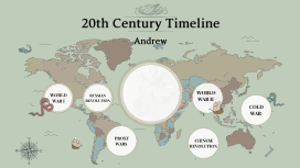
Transcript: Pike’s goals were to meet with Indian tribes and to gather information on the area’s natural history. While sailing on the Arkansas River, Pike's party was captured by Spanish soldiers because they were exploring land that Spain owned. Pike was held in Mexico for six months before being released. Most of his expedition notes were confiscated. Though his expeditions mapped new expanses of the United States. Pike's journals didn't have the same quality as Lewis and Clark's. Regarding the headwaters of the Mississippi, Pike had misidentified the real source, but he did learn much about the upper Mississippi region. Pike reported on the military weakness of Santa Fe. The report pronounced American curiosity about the expanding western frontier of the young nation and, helped encourage future U.S. expansion to Texas. Pike's Peak Lewis and Clark's camp for the winter (Fort Mandan) Zebulon Pike Where Lewis and Clark reached the Pacific Ocean (Fort Clatsop) Lewis and Clark's Expedition The Louisiana Purchase Zebulon Pike's expedition The Lewis and Clark expedition was a journey to explore the Louisiana Purchase. President Thomas Jefferson sent the Corps of Discovery, under the command of Meriwether Lewis, and they were to map the new territory, assess its natural resources, and make contact with its inhabitants, befriending them if possible. On the trip, Clark oversaw the men and carefully mapped the route, and Lewis made scientific observations and collected specimens of animals and plants. During their expedition, the group made note of the people, the land, the rivers, the mountains, the plants and animals that they had seen. They were able to draw accurate and detailed maps of the North American continent. The expedition noted that no water route to the Pacific existed, and that peaceful contact was made between Native American tribes. They explored many western lands and paths across the Rockies. They were also able to collect valuable information about western plants and animals. France had blocked off the port of New Orleans to Americans, and so President Jefferson sent a representative to France in attempt to buy a piece of New Orleans. Instead, the United States was able to inquire 500,000,000 acres of land for 3 cents an acre. That land was known as the Louisiana Purchase. The United States gained about 828,000 square miles that was French territory in 1803. At the time, purchasing this land doubled the size of the United States. 15 states were eventually created from this land agreement. The new territory opened up new land for settlement, made more room for the population, and increased economic opportunities. Lewis and Clark's Expedition The Louisiana Purchase


